The 5 Main Benefits of Using Drones in Construction
1. Reduce Costs
Our Drones provide insights that allow
Identifying problems in advance, preventing costly delays
Saving time in data collection and reduce labor hours required for the job.
Regular grade evaluations which prevent building in the wrong place and other costly errors that could lead to rework and delays.
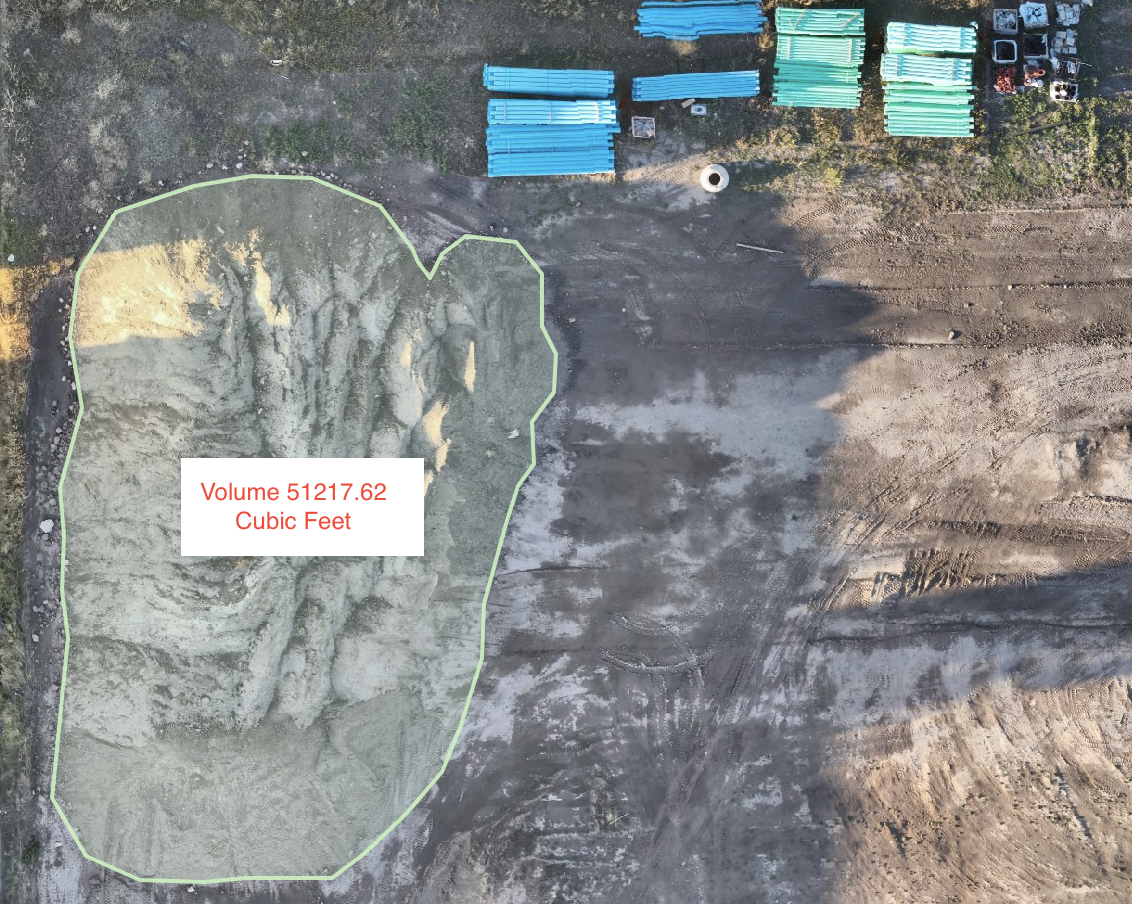
Performing stockpile volume measurements to catch delivery errors early and ensure you received what you paid for.
Improving efficiency and helping you stay on schedule.
2. Increase Safety
We fly drones quickly over these areas and collect data to make work determinations. This provides fast, on-demand information to inform your work and removes the need for employees to put themselves in hazardous situations, keeping site inspectors out of harm's way. Drone data can also clearly show how a site is being maintained, which can have important implications for safety.
Another safety consideration for construction sites is trying to keep civilians out of the site. Aerial data from a drone can quickly help you see potential access points so you can close them off, preventing people from entering the site.

3. Improved Data = Improved Decision Making
Knowledge is power, and data is king.
Because data constantly evolves, factors like heavy rainfall can rapidly change site conditions, impacting the work required.
If issues are overlooked during the site report creation process, even for a few days, it can lead to setbacks and costly project delays. Drones offer a solution by providing real-time data collection, empowering project managers to make informed decisions promptly and avoid disruptions in project timelines.
4. Planing Better
The data gathered by drones enhances project planning, offering a precise overview of the site prior to commencement.
Utilizing drone data, such as photos, videos, ortho-mosaics, and 3D models, aids planners in accurately envisioning the final project layout.
Moreover, 3D models derived from drone data facilitate the identification of elevation differences and drainage zones, which is essential for strategic decisions on excavation, construction, and stockpile placement during the project.
5. Make Operations Scalable and Repeatable
Our drones gather data that improves project planning by providing an accurate site overview before starting.
Additionally, 3D models from DroneVue data assist in identifying elevation changes and drainage areas, which is crucial for strategic decisions on excavation, construction, and stockpile positioning throughout the project.
We provide you with all the information you need to meet deadlines, stay safe, reduce costs, and communicate effectively.
Ortho-Mosaic Maps
3D Maps
Progress Reports
Volumetric Stockpile Calculations
Videos and Pictures
Let’s work together.
Interested in working together? Fill out some info and we will be in touch shortly! We can't wait to hear from you!